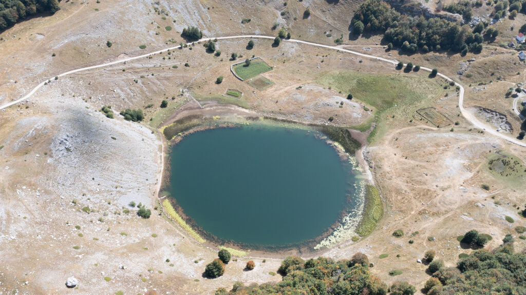
The Bukumir lake is a hydrographic pearl of the mountain Zijevo or a drop of water in the stone sea.Lake Bukumir is located on the northwestern slopes of the Zije(o)vo mountain. The name of the mountain comes from the male name “Zijo”, a common diminutive in the region of Kuci which is north of Podgorica (the capital city), from the name “Zivan” or “Zivko”. The mountain is bordered on the east and southeast by the canyon of the Cijevna River and the state border with Albania, on the southwest by the Zeta Plain, on the west by the Moraca river and the river Mala Rijeka, and on the north by the mountain ridges of Planinica, Zvekotuša, Djebeze and Torac and Rikavacko Lake. It is dominated by karst landforms, above-ground water scarcity and rich hydrological subsoil. There are 21 peaks in Zijevo with an altitude of over 2,000 meters.
Bukumir lake is a glacial lake located within the area of Kuci, in the municipality of Podgorica, at 1443 m above sea level. It is bordered by a 40m high glacial overhang (frontal moraine). It is one of the smaller glacial lakes of Montenegro. The tectonically predisposed valley was transformed into a glacial valley (wave) during the Pleistocene (ice age). The glacier that moved from the direction of Bigez, Pasjak and the surrounding peaks descended towards the river Mala rijeka, leaving behind moraines (glacial material) on which katuns (shepherd’s cottage) are built today. The lake receives its water through precipitation and occasional springs. It is 210 m long, 130 m wide and up to 17 m deep. The surface of the lake is 19320 m².
Today, Bukumir Lake is a popular picnic spot for the citizens of Podgorica.
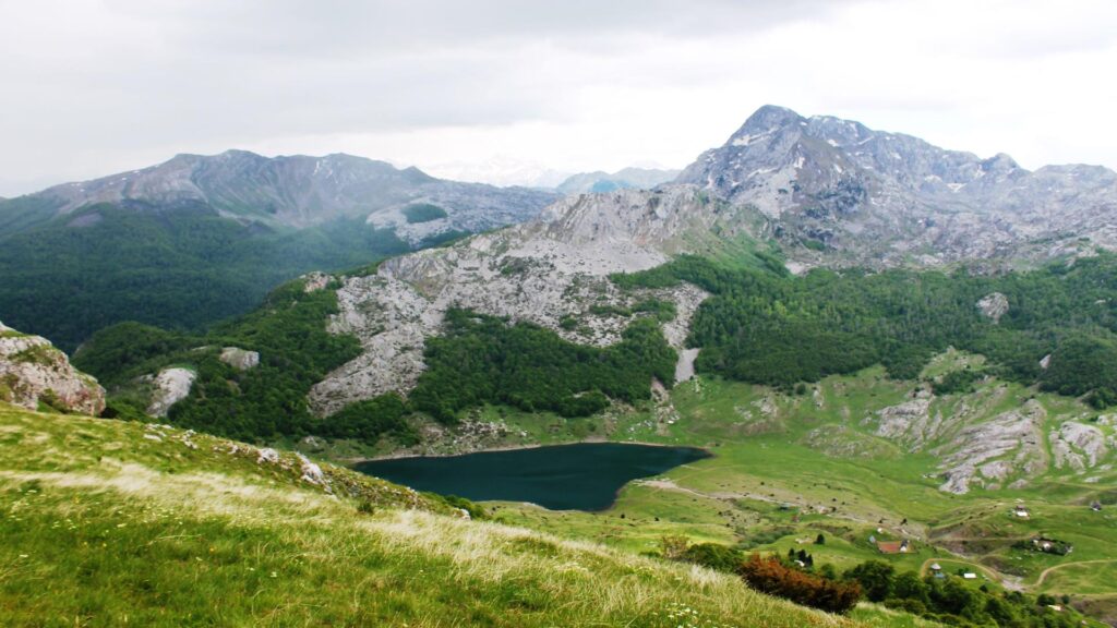
The Rikavacko lake is located at the foot of Vila peak (2093m altitude ) which belongs to the Zije(o)vo massif near the border with Albania. Its name comes from the word “roar”, because during strong winds, the water surface ripples and hits the shores, which produces a sound that the inhabitants of Kuci referred to as a roar.
The lake is located at 1314 meters above sea level. The waters of the Rikavac stream flow into it, and the water drains through the chasm towards the basins of the rivers Cijevna and Ribnica. It mostly receives water through high precipitation (rain and snow). The lake is 525 m long, 235 m wide and 13.9 m deep and it is of glacial origin.
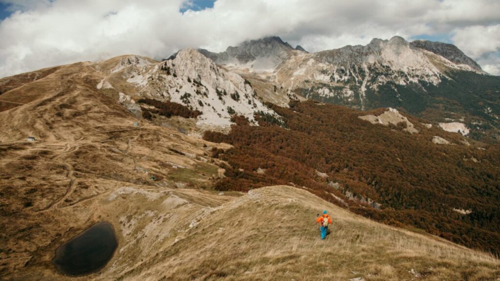
Sumor is a smaller hydrological object located on the slopes of the Planinica peak, and not far from the Sumor peak, after which it is named. Its greatest depth of the lakelet is up to 2 m. In the immediate vicinity is the Orthodox Church of St. Ilija.
The lakelet Sumor is located in the eastern part of the Komovi Nature Park.
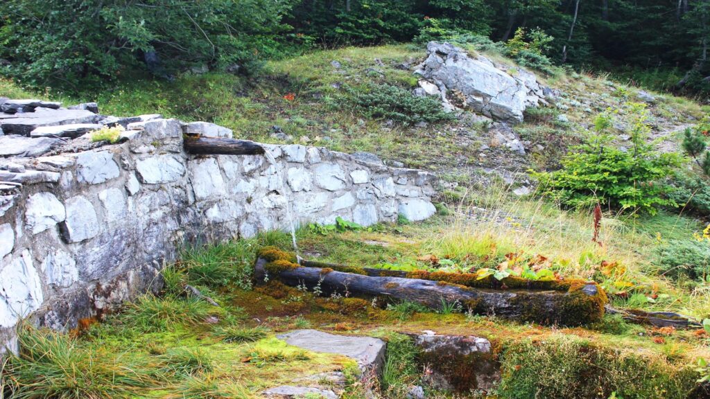
The wellspring of White (Fairy) Water springs up from below of the top of mountain Planinice and is one of the upper, source branches of the Tara River. The water from this spring is of A quality. The wellspring of the Fairy Water was named after the fairy of Komovi. The Legend of the Fairy’s Water is the story of the tragic love between a fairy and a young man from the Kuci tribe, Đoko Nikolin Popović.
The spring serves as a temporary gathering place for Kuci tribe for Ilindan (second August) as well as for numerous mountaineers who climb the peaks of Komovi.
It is located in the eastern part of the Komovi Nature Park and the spring water is extremely cold.
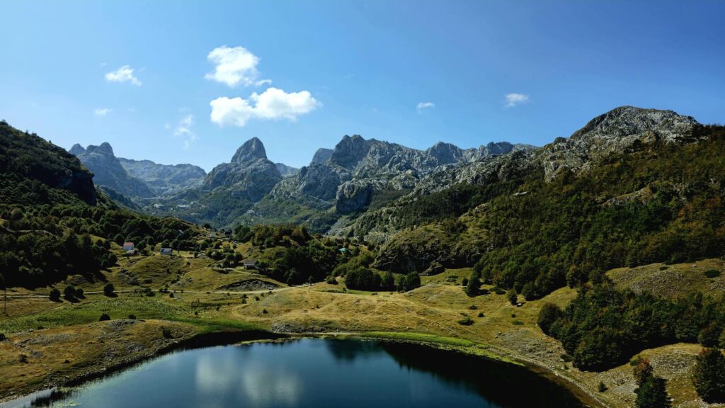
The viewpoint is located on the frontal moraine of Bukumir Lake, which rises 40 m above the lake. The valley from the bottom picture represented the direction of glacier movement in the process of creating the surrounding relief.
In the Podgorica part of the Komovi Nature Park, there are 13 peaks with an altitude of over 2000 meters.
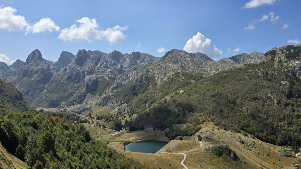
The viewpoint is located on the slopes of Torac Peak, which represents the watershed between the Adriatic and Black Sea basins.
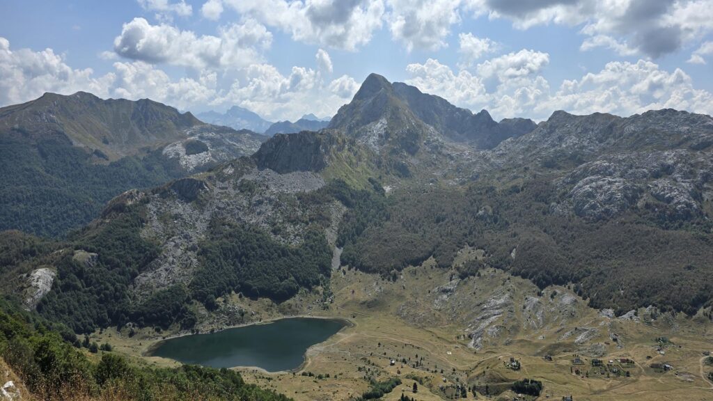
The viewpoint is located above the fault, on the border of two geotectonic units: Kuci and Durmitor geological cover.
The mountain ridge above Lake Rikavac is the state border between Montenegro and Albania.
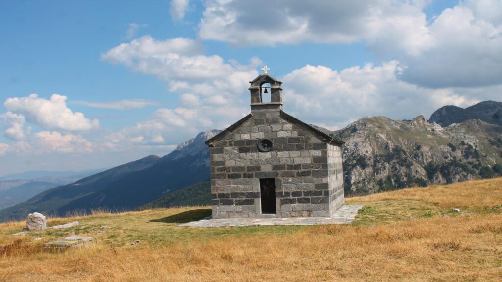
The orthodox church of St. Elijah was built on the Krst of Prevlaka, below Sumora and Planinica mountains, at an altitude of 1800 meters. It was built in 1900 by Prince Nikola Petrovic, for the repose of the soul of his father Duke Mirko Petrovic, and in honor of the brave Kuci tribe.
In this place, on Ilindan (August 2nd) every year, a national assembly is held.It is known for the fact that it is located at the highest altitude among all the churches in Montenegro, and it is also one of the highest in Europe.
The church is located in the eastern part of the Komovi Nature Park.
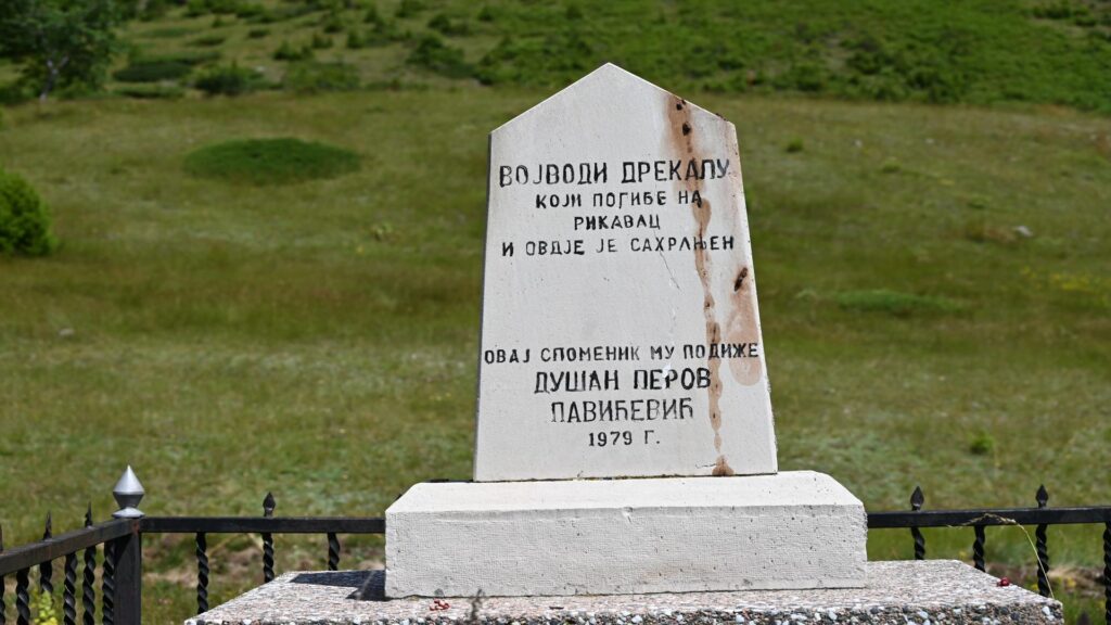
The Monument to Duke Drekale is located in Donji Rikavac, in the katun (shepherd’s cottage) of Jokanovic. It is not known when it was built, but it was renovated in 1979.
Duke Drekale and his son Nikola were killed in that place. On the opposite side were members of the Klimenti people. Drekale is the progenitor of Drekalovic family surname. He left behind a son, Lale, from which all Novokuci families originate.
The monument is located in the southern part of the , Komovi” Nature Park.
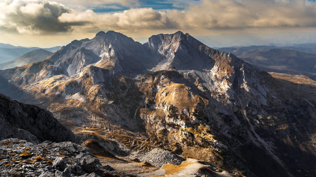
With an altitude of 2487 meters above sea level. is the highest peak of Mountain Komovi, and also the highest point of the municipality of Podgorica. It is located in the northeastern part of the Park. Despite its fragility and reef exposure, it is visited by a large number of mountaineers throughout the year. In the Komovi massif there is the longest rock creep in Montenegro.
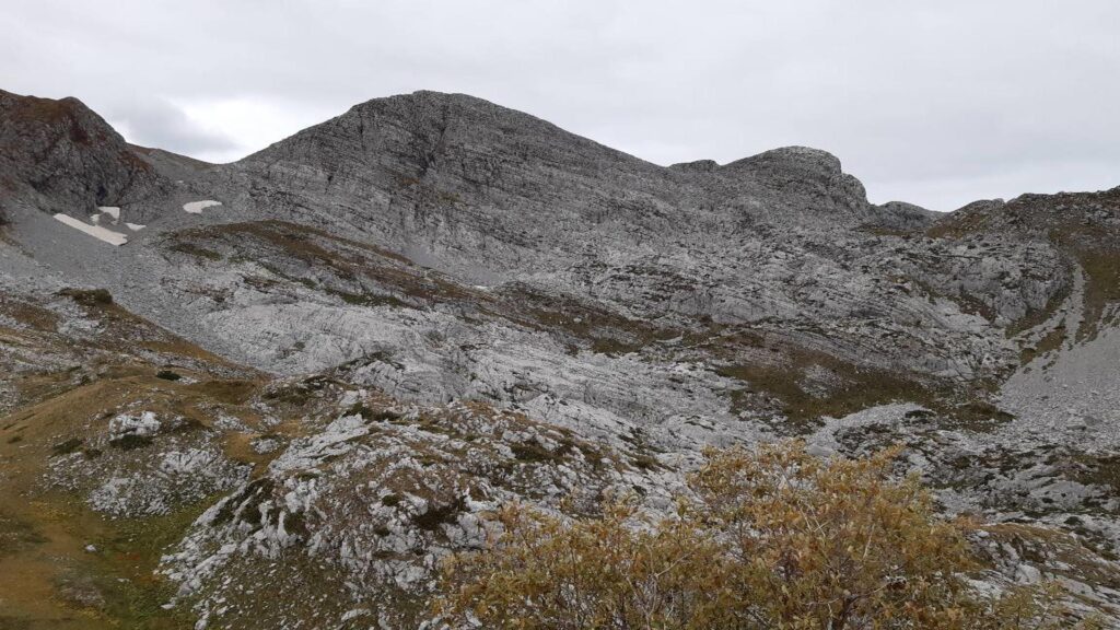
At 2184 meters above sea level, it is the highest peak of Mount Zijevo. The name “surdup” means precipice. It represents a set of peaks that ends with Raćeski vrh and Treskavec. It is located on the southern borders of the Komovi Nature Park.
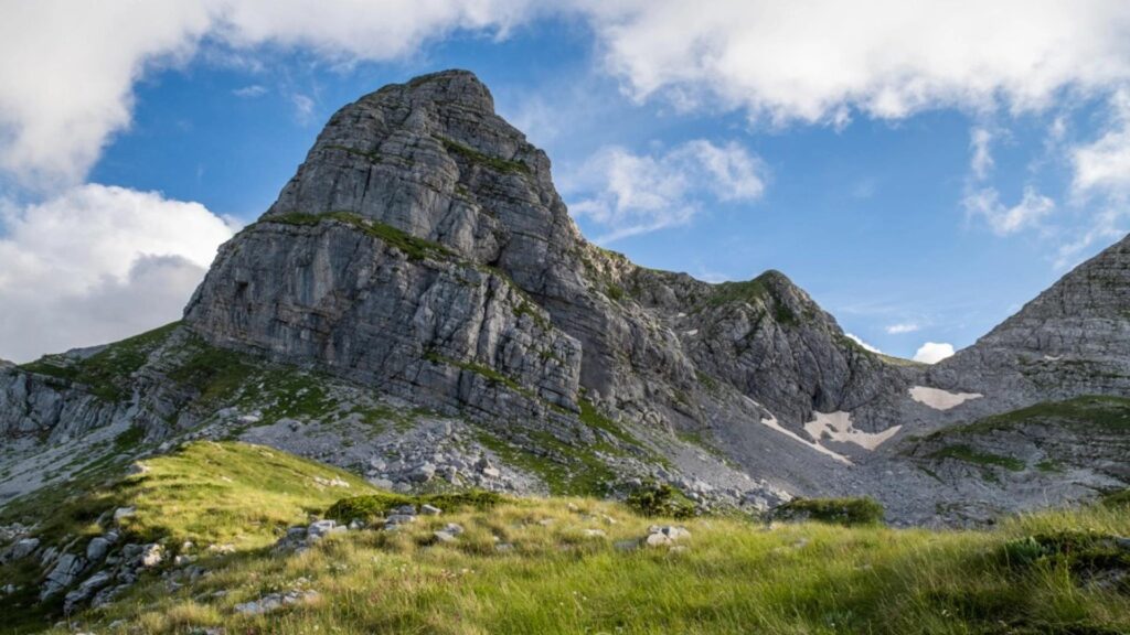
The second is the highest peak of the mountain Zije(o)vo. It is known for its striking northern side. It got its name from its shield-like or hoop-like appearance. Along with neighboring Surdup, the most visited peak is Kucka krajina and Zijevo mountain.
It is located on the southern borders of the Komovi Nature Park.
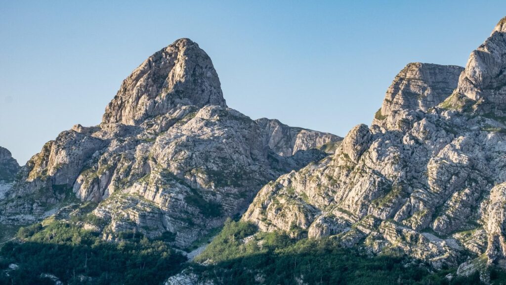
The second most challenging peak is the Zijevo mountain. It represents the symbol of the Bukumir hinterland and is the most common photo motif besides the Bukumir lake. It is a real challenge for both mountaineers and alpinists and it is located in the southern part of the Komovi Nature Park.
CT-1 transversal is a mountaineering transversal of “Mountains of Montenegro” and it is the first transversal in Montenegro. It was established in 1987, from Verusa via Zije(o)vo, Komovi, Bjelasica and Sinja(je)vina, to The Black Lake on Durmitor. The original route was partly extended and changed in the area of Zijovo, Bjelasica and Sinjajevina, which increased its attractiveness. As it joins the national parks of “Biogradska gora” and “Durmitor” it has gained exceptional touristic importance. A special attraction on the route is made up of numerous viewpoints as well as glacial lakes: Bukumir, Rikavacko, Ursulovacko, Sisko, Zabojsko, Zminicko and the Black Lake.
The transversal is planned for an eight-day hike.
Its length from Verusa to the Black Lake is 172.5 km. In the case when the control point is Bukumir Lake, then it is 160.5 km.